Myar Valley Tour
Highlights
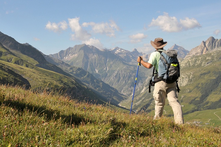
The soothing and calming beauty of Lahauli Myar Valley with the beautiful campsites makes one go crazy. Also, Miyar Glacier is a beauty one of its kind which will lead your way to the beautiful snowfields and the panoramas of Kang la from where you can move further to another beautiful place which is Zanskar. The passage is unforgettable.
Itinerary
You should know the route before you start to trek. You start from Leh (3.505m) and take a jeep to the Tso Moriri Lake (4.530m). It will take around 7-8 hours. The time is though long but on the way you get to see beautiful views. You see Lake Tarsang Tso. Korzok village is near to Tso Moriri lake. Here you can visit a monastery. You spend your first night here near the camping lake.
There is a slight slope here and is enclosed by a place called as the Shakali. The place has just 4 houses and overlooks the Myar river. You now cross a descent. Here you cross a bridge and continue moving towards the left to Chimrat. The road is now on the right side of the river and is also parallel to the electric line. You will get to see more of the houses this time. Now you reach Karpat bridge. There you will find a trail that will lead you to Gordar pass (4.800m) and also to Sdach village in Pangi region.
Keep moving towards your right. At a distance of one kilometer, it descends into a sand beach. Walk two kilometers more, you reach Changut and Charput, these are just two small villages. They are near the two streams. You continue moving near the flat terrain. Then you get to see some houses and reach Gompa temple. It is recently built. From here, the trail to Karpat pass and also to Menthosa starts now. There will be a short descent now. You will have to take a jula now to cross the river and beyond that, a trail at a height of 20 m reaches to a plateau and you see some of the houses of Chaling. You continue and you see some more of the houses. Now you come across moraines and also some of the unsafe bridges. The route starts descending now and as you reach Kanjar, it starts ascending. Kanjar is at a distance of 3.5 km from Chaling. It is a small village where there are very less houses and is at a distance of some 100 km above the water. A lot of space is there where one can easily pitch in tents.
A lot of trails are there on your way. After which the track is very clear and it continues going up and down. You will get to see a lot of herds and also other variety of shepherds. The valley broadens and it takes a different U shape. Towards the North, you will be able to see a flat zone. One valley allows you to reach a pass after which you will be able to go to Jancar Sumdo which is below Shingo la. Keep moving on the flat terrain. You will get to see a lot of beautiful snowfields and also glaciers. There is also a bridge which joins the two ends. From there, you climb and you get to see a big rock above known as Phuk Sar. There is also supposed to be a meditation cave. The space is enough where you can pitch a tent.
A lot of ups and downs are here. After two hours, you pass boulders and move further. At last, you reach a hillock which is of 20 m. From this place, you will be able to see all the plains and you will also see all the branches of the rivers spread out. Also, a little bit of the glacier can be seen from here. Not much, but a slight space is there to pitch the tent.
A side stream can be seen here. You have to cross the chilly water before you are able to reach the moraine. The track can be seen very clearly. You also get to see some cairns, of two types the small ones and also the big ones. Also, there are small open spaces with snow, pools and grass. Also, a lot of alpine stars can be seen. The trail first runs between the meadow and then along the upper moraine. It runs at a distance of 100 m above the glacier. And, then continues above the slope. You reach between the Myar and the glacier and then while going down, you are able to notice a lot of things like that of sinkholes and also the lakes. YYou might get tired while crossing the glacier. It is all covered with debris and also the boulders. Around two hours will be taken when you walk 500m. The track is full of lakes and also a lot of climbs. You will have to climb for 100m. And, then after descending, you reach an open space at a height of 4.500 m.
After descending on the Myar glacier, you will get to see a region like that of an ice highway. Keep on descending more and more. You will see that now the valley turning itself towards the north. You will reach a spot now which will be near the left of the river where you can pitch the tents.
As you are walking on the glacier now, you are still not able to see the valley. On both the sides, you get to see beautiful views, on right side you see peaks and the glaciers while on the left you see valleys and glaciers. Try to avoid some areas that are full of cravesses. One more climb is there beyond which the glacier bends itself. You get to see a view where four glaciers are meeting. The sight is beautiful. One ice flow can be seen. Descend into the basin as you pass the confluence. You will get to see some blue turquoise channels flowing. Many creavasses can be seen here. Climb again and turn towards your west where you get to see a spot like region. Climb some 200 m more. Stay on your right. Kangla is not near the valley head. One branch of the Myar glacier climbs up and reaches at a height of 6.000 m. The pass is one the ridge of the glacier. On the top of which alobe gets detached goes down to the Temasha valley whose height is 5.460 m. Try and come back on the glacier again.. Go down on the terrain back and you will soon see a place which is full of marsh and you can pitch your tents here.
The journey is tedious. The valley is narrow. After some time, you will see open areas. After some turns, Zanskar appears. As the height is reduced, you get to see yaks and also stone enclosures. The descent is very easy here. But it is also steep in nature. Keep moving towards the west and as you cross a bridge on the Temasha valley, you reach another bridge called as the Pibcha. Pibcha is a small village which is situated on the river known as Zanskar. This is the nostalgic moment of the Tour when you have to bid adios to this beautiful place, knowing in your heart that one day you will come back here again. After early Breakfast, & transfer to Airport for your onward journey with memories of Your Festigo Journey.
The prices are Inclusive of
- Free airport pickup (after arrival in Leh)
- Transport to and from the trailhead
- Hotel Stay on bed & breakfast basis in Leh
- Knowledgeable and English Speaking Guide
- Packhorses with Horsemen
- Food/Beverages (Breakfast, Lunchbox, Dinner) : Abundant and accurately prepared by a professional cook. Continental, Indian, Chinese, Ladakhi & Tibetan styles.
The prices are Exclusive of
- Goods & Service Tax as applicable.
- Any Air/train fares
- Any Kind of Personal Expenses or Optional Tours / Extra Meals Ordered
- Monument Entrances, Rafting & Camel Safari Charges.
- Anything not specifically mentioned under the Inclusions.
- Tips, Insurance, Laundry, Phone Calls.
- Any Kind of Drinks (Alcoholic, Mineral, Aerated)
- Cost incidental to any change in the itinerary/ stay on account of flight cancellation due to bad weather, ill health, roadblocks and/or any factors beyond control.